Proposed developments like Marinus Link trigger regulatory processes. Marinus Link is seeking access to properties, to undertake the required field investigations on areas which may be impacted by the proposed route, in order to understand and assess potential impacts and make refinements to the route where necessary.
Field surveys and investigations will support applications to State and Commonwealth environmental, planning and cultural heritage impact assessment and approvals processes.
Formal opportunities to make submissions within this regulatory process will be available. Marinus Link will continue to update the community as these opportunities arise.
Works notifications – Investigations
March 2025 – Heybridge – Geotechnical investigations
September 2024 – Heybridge – Geotechnical investigations
August 2024 – Waratah Bay Beach – Geotechnical investigations
August 2024 – Between Hazelwood and Buffalo – Geotechnical investigations
July 2024 – Waratah Bay – Marine surveys
September 2023 – Between Hazelwood and Driffield – Geotechnical investigations
September 2023 – Waratah Bay – Geophysical surveys
November 2022 – Waratah Bay – Geotechnical and Cultural Heritage Investigations
November 2022 – Between Waratah Bay and Mirboo North – Geotechnical investigations
October 2022 – Heybridge, Tasmania – Geotechnical investigations
August 2022 – Waratah Bay Beach, Victoria – Non-invasive activities
July 2022 – Heybridge, Tasmania – Geotechnical investigations
23 May 2022 – Victoria – Geotechnical investigations
Late May 2022 – Heybridge, Tasmania – Geotechnical investigations
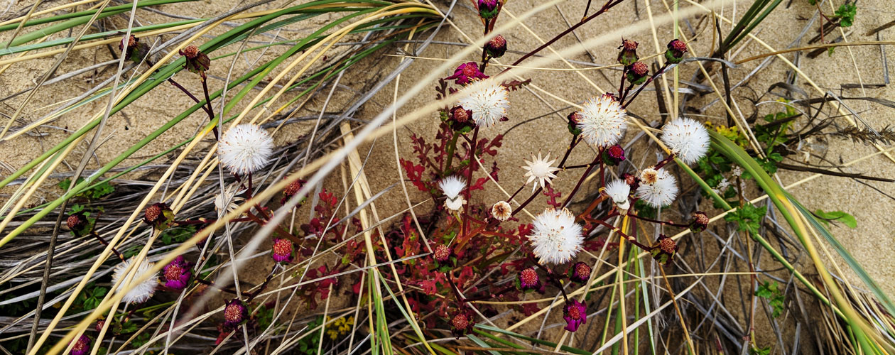
Ecology and field surveys
To understand the potential ecological impacts of the proposed transmission developments, Marinus Link needs field information on the existing ecological values.
Who will conduct the ecology surveys?
Experienced, expert ecologists will conduct the ecology surveys on behalf of Marinus Link. These consultants are highly qualified in assessing the potential environmental impacts of a project of this scale.
What are they looking for?
Deeper information on existing ecological values is identified through these surveys. The ecologists will record plants and animals that exist along the proposed route and identify those that are protected under State and Commonwealth law. Should the developments proceed, it is likely that some areas of vegetation will need to be disturbed or cleared. This can impact on these protected plants and animals.
What do ecology surveys involve?
Target areas within the survey corridor will be identified and surveyed using a ‘meander search method’. This involves walking the survey area in a randomised manner to record all plant species encountered and also targeting habitats and vegetation communities that are likely to hold threatened plants and animals. Collection of plant specimens may be required, for which the necessary permits are held by the ecologists engaged to conduct the survey. No trapping or invasive survey techniques are planned for this survey.
Cultural heritage field surveys
Who will conduct the surveys?
Field investigations to survey cultural heritage will be undertaken by archaeologists and in some situations, representatives of local Aboriginal communities may be in attendance to assist. They will investigate the area for the presence or absence of Aboriginal and historic cultural heritage values and provide advice on the ongoing management of these values, if found.
What are they looking for?
The aim of the cultural heritage field surveys is to identify Aboriginal and historic cultural heritage sites and areas of potential archaeological sensitivity that may be present within a survey corridor. These surveys will contribute to an overall assessment of the Aboriginal and archaeological values and sensitivity of the area potentially impacted by the proposed development.
What do the surveys involve?
The surveys will involve walking a series of survey transects along the entire length of the proposed route and any other areas that have been identified for potential use or disturbance, such as access tracks.
Geotechnical investigations
Marinus Link is undertaking geotechnical investigations to inform the design and construction requirements of the project. These investigations are undertaken to verify soil, rock and other ground conditions in order to determine site suitability for construction. They also allow us to progress with more detailed designs and cost estimates. More importantly, they help us minimise the project’s impact on the environment, community, heritage, and existing infrastructure.
Geotechnical investigations are continuing throughout 2022 on private properties and public land to assist with the planning and assessment of Marinus Link.
Through our dedicated landholder liaison officers, we continue to work directly with landholders to arrange access to properties. We will only be testing on private properties and crown land where we have permission.
We are very appreciative of the time given by landholders and lessees in discussing the project with us and providing access to conduct this important work.